If you want to move from trekking to climbing a more technical peak, choose the Mt. Nun Peak Expedition. At 7,135 meters, it is the highest peak in the Zanskar Valley of Ladakh.
Overview
Nun Peak Expedition Overview
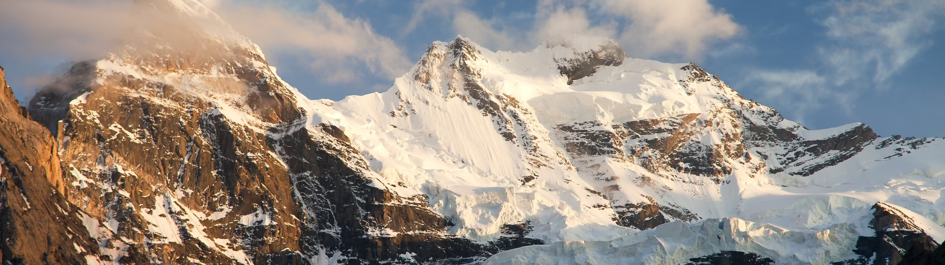
If you want to move from trekking to technical climbing, the Mount Nun Peak expedition is a great choice. It is the highest peak in the Zanskar Valley of Ladakh, standing at 7,135 meters. You can feel its power as soon as you see it. The mountain has a strong presence, with its steep slopes, sudden blizzards, and unpredictable nature. Mount Nun is part of the Nun Kun massif and is located in the Suru Valley of Kargil district, about 250 km east of Srinagar. It is separated from its shorter twin, Mt. Kun (7,077 m), by a 4 km snow plateau.
The Himalayas have long attracted mountaineers looking for thrilling challenges. Among many known and unknown peaks, Mt. Nun draws climbers from around the world. For some, it is a stepping stone, while for others, it is a significant challenge. First climbed in 1953, it is a technical climb that involves navigating tricky terrain in severe cold and strong winds.
The mountain’s crevasse-filled surface and unpredictable weather make it tougher to climb than many other 7,000 m peaks. It requires real determination and teamwork. Because it is a technical climb, you need specific knowledge of climbing equipment and skills for high-altitude conditions. Experience in extreme cold and at least one climb over 6,500 m is necessary.
Itinerary
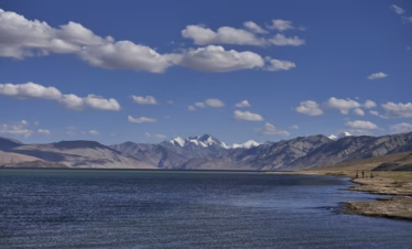
The trek begins in Leh, a key spot in Ladakh known for its high peaks. It is a popular place for tourists and easy to reach. If you need help getting to this high-altitude area, check out this article (click here).
On the first day, climbers will arrive in Leh and settle into their accommodation. Since many will come from sea level, it’s important to give your body time to adjust to the thinner mountain air.
On day two, we will rest and help our bodies adjust to the high altitude. This is important to help prevent health issues. You can explore the local market and enjoy the vibrant culture of this mountain city. A little walking around will help with acclimatization. Use this time to check your packing list and buy any last-minute items you may need for the expedition. Leh has a great market for trekking supplies.
While we acclimatize, we will also meet as a group for a debriefing session. This is a chance to get to know each other and discuss our schedule for the upcoming days. We will cover what to expect, important do's and don'ts in the mountains, and how to respect the environment during our trip.
Distance: 217 km
Time Taken: 6-7 hours drive
Today is an important day! You will start your expedition by driving toward Mount Nun. You will also meet the Sherpas and support staff, who are key to our team. Expect to leave after breakfast. The drive will take about 6-7 hours.
Distance: 65 km
Time Taken: 2 hours
You drive from Kargil to Tangol, a small village by the Suru River. The drive takes about two hours. You lose your cellular signal as soon as you leave Kargil, so you can focus on the beautiful landscape outside your car window. You see narrow roads, green villages, and people carrying firewood. The lush greens contrast with the dry brown mountains, and there’s a unique scent in the air.
As you drive up the mountain to a higher altitude, you see a view of life in the valley below. You notice small gardens behind the stone houses. The local ecosystem seems very self-sufficient. People work on their land with sickles, showing the humility of mountain life. The houses have high ceilings and low doors, which require you to bend down to enter, reflecting the simple nature of mountain culture.
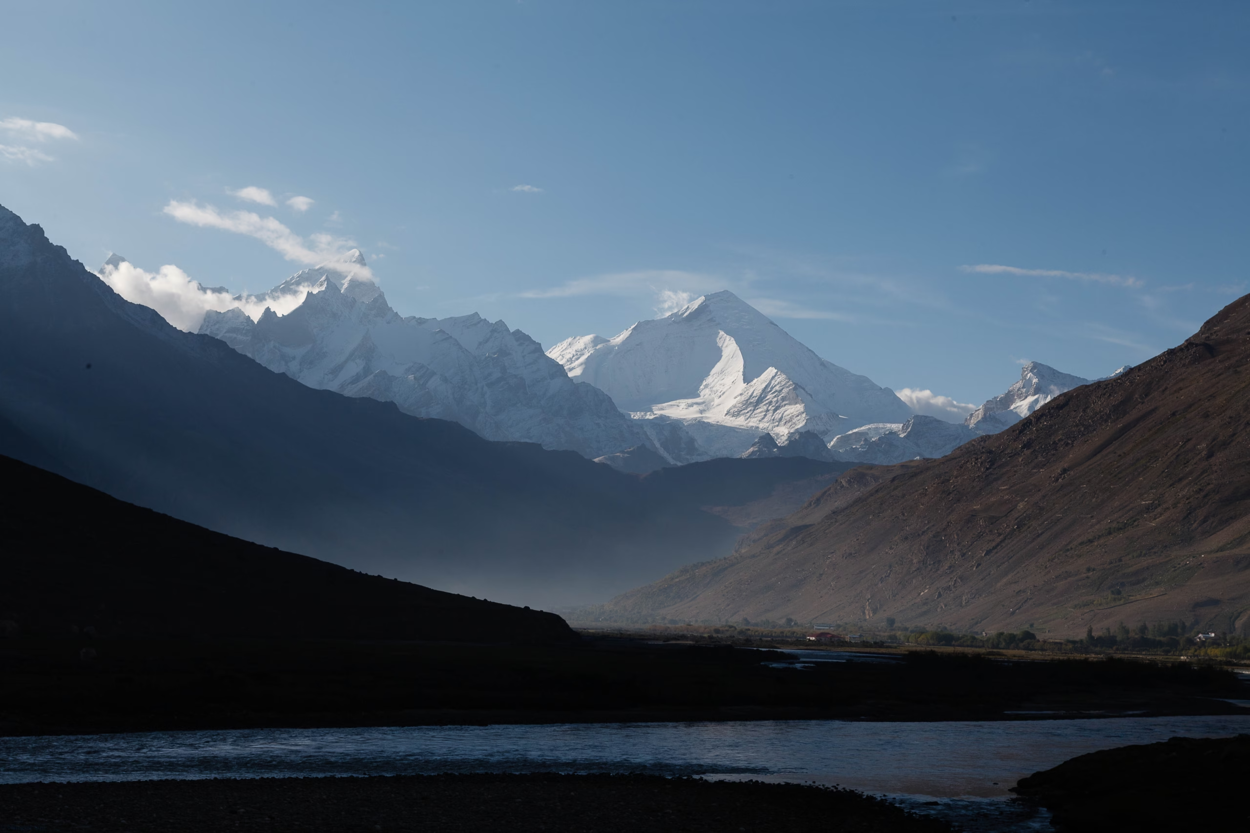
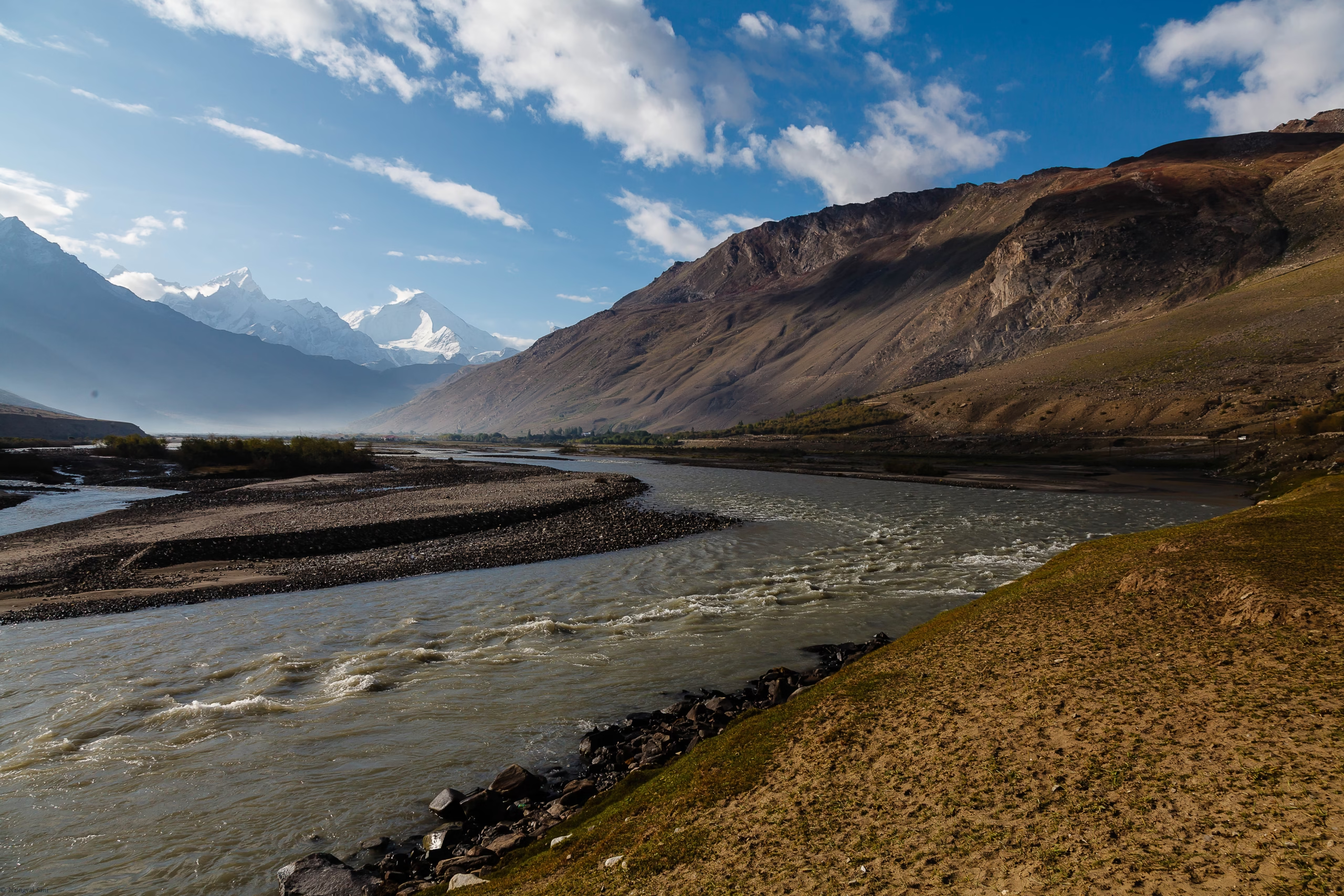
Half an hour into the drive, the valley widens, and the river grows larger. The mountains become smoother and greener, and streams of clean water join the river. After fifteen more minutes, you see snowy peaks for the first time. This bright white changes the landscape’s color palette from earthen tones.
As you continue, you leave smooth roads for rough trails and see rocky mountains. The greens of the lower areas have faded. You notice large boulders piled together like a game of Tetris. You see rows of apricot trees, smooth gray roads, and bright yellow lines stretching out in the distance, adding to the beauty of the landscape.
You also see mud-brown houses with green wooden windows, matching the colors of the mountains. Entire villages sit on high ground in the valley next to the strong Suru River.
Since we have gained some height today, we will go for a short acclimatization walk in the evening.
You will have a rest and acclimatization day at Tangol. During this time, you will learn basic equipment and knots. You will stay overnight in the camps.
Distance: 7-8 km
Time Taken: 7 hours trek
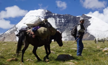
Today, we start the actual trek. We will aim to leave right after breakfast since it will be a long day. You will gain 900 meters in elevation, and carrying your backpack will make it challenging. The trek begins by crossing a sturdy bridge over a deep gorge and a river. This leads you to the last village before you leave civilisation.
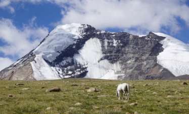
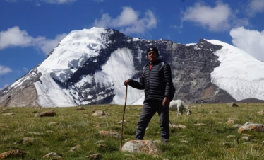
The route to the base camp takes you through small villages with lush green fields and pink flowers. You will see locals swiftly moving up and down steep slopes. Cattle will dot the landscape as you leave the green fields at the mountain's foot and enter a rocky area with narrow trails. The ground will be dry but full of colourful flowers growing from the cracks.
The mountains here have sharp, pointed peaks and are brown and dry above a certain point. At the foot, you will find lush green fields. You will walk on boulders and loose rocks along the shepherd trails that cut through the dry land.
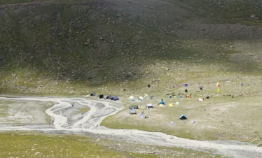
After three hours of climbing, you will reach the pass. The landscape and the air will change on the other side. After the steep climb, you will descend into a chillier valley, which feels more rustic. You will cross miles of moraine and glaciers until you reach the base of the waterfalls. This last part of the climb is steep (around a 60-degree angle) and slippery due to loose rocks. The base camp awaits you at the top of the waterfall. Your final challenge will be crossing streams of water from the waterfall to reach your tents, which will be your home for the next few days.
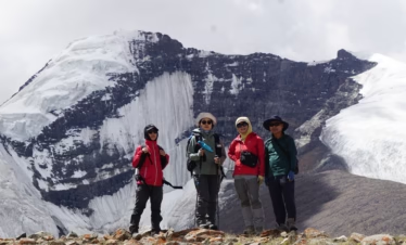
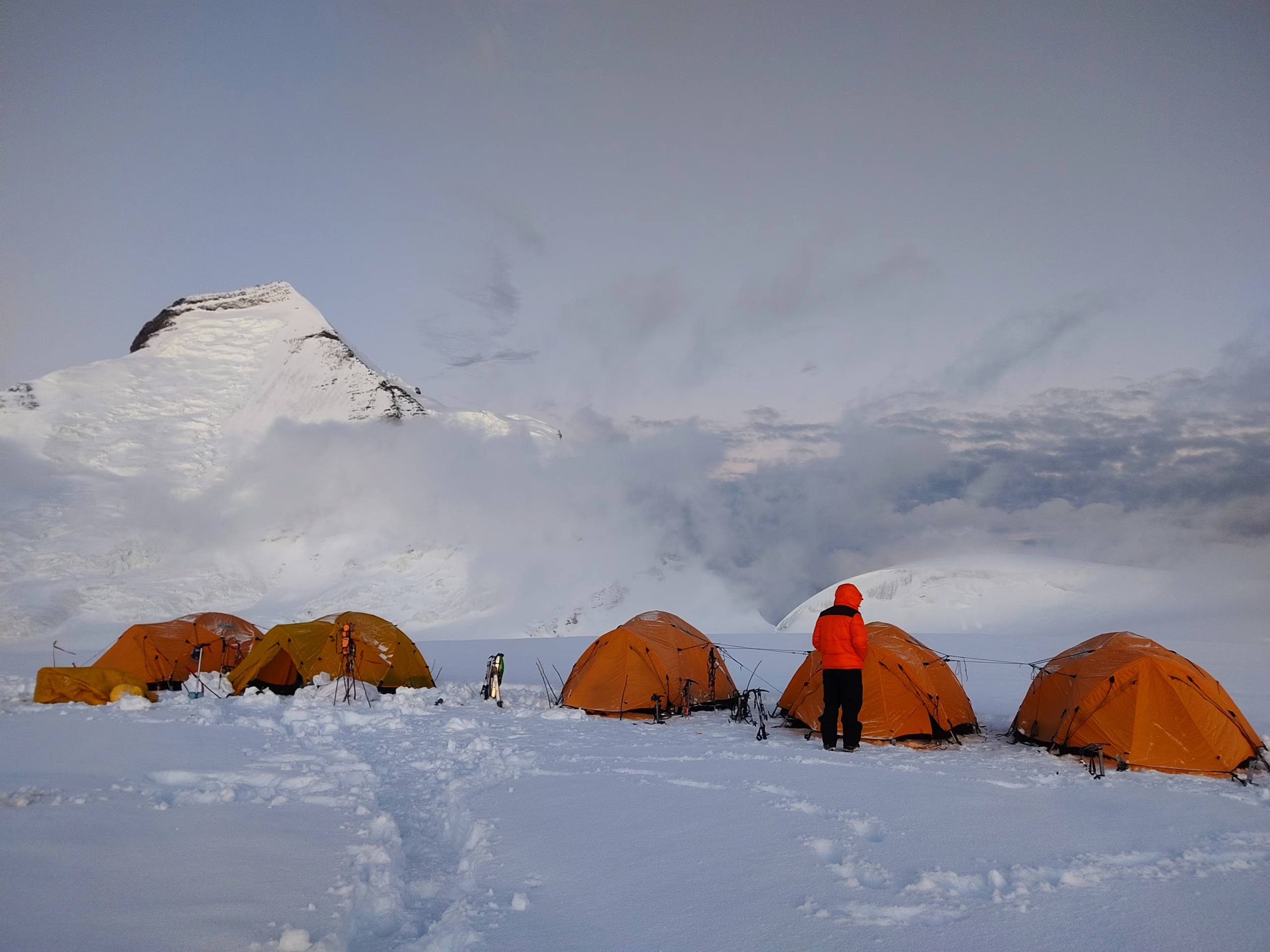
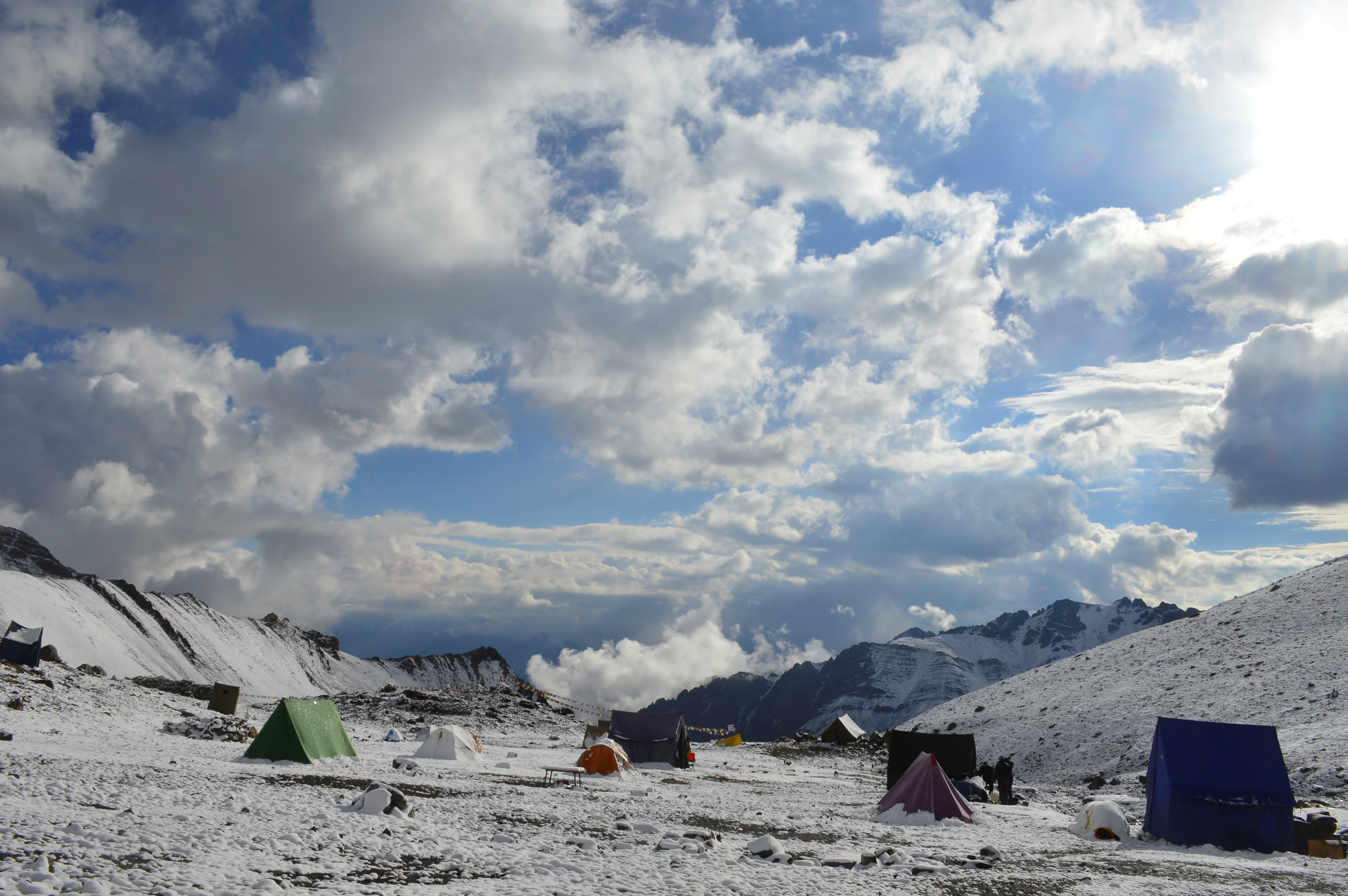
The day begins with a puja. The base camp for Mt. Nun is colorful, filled with prayer flags and small stone structures where we offer our prayers to the mountain gods and thank them for letting us be there. This ritual helps the team seek blessings for safety and success. It ends with a sip of brandy and some sweets to warm us and connect us to the mountain, making us feel like we belong.
At base camp, we have a lot to accomplish. We will set up our gear and get technical training on the icy slopes nearby. Before that, we have a full day to rest and adjust to the altitude, temperature, and terrain of the base camp, which is at 4600 meters, about 800 meters higher than Tangol.
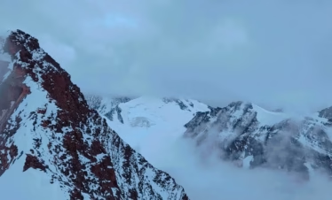
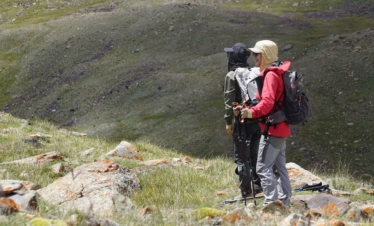
When you start mountaineering, conditions at high altitudes can be unpredictable. You will often need to adjust your plans based on the current situation. It is difficult to provide a fixed schedule like we do for treks. However, a rough schedule usually involves rotating between camps, which is an important part of acclimatization during high-altitude expeditions. Mt. Nun has three camps at 5,550M, 6,100M, and 6,400M above the basecamp.
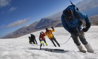
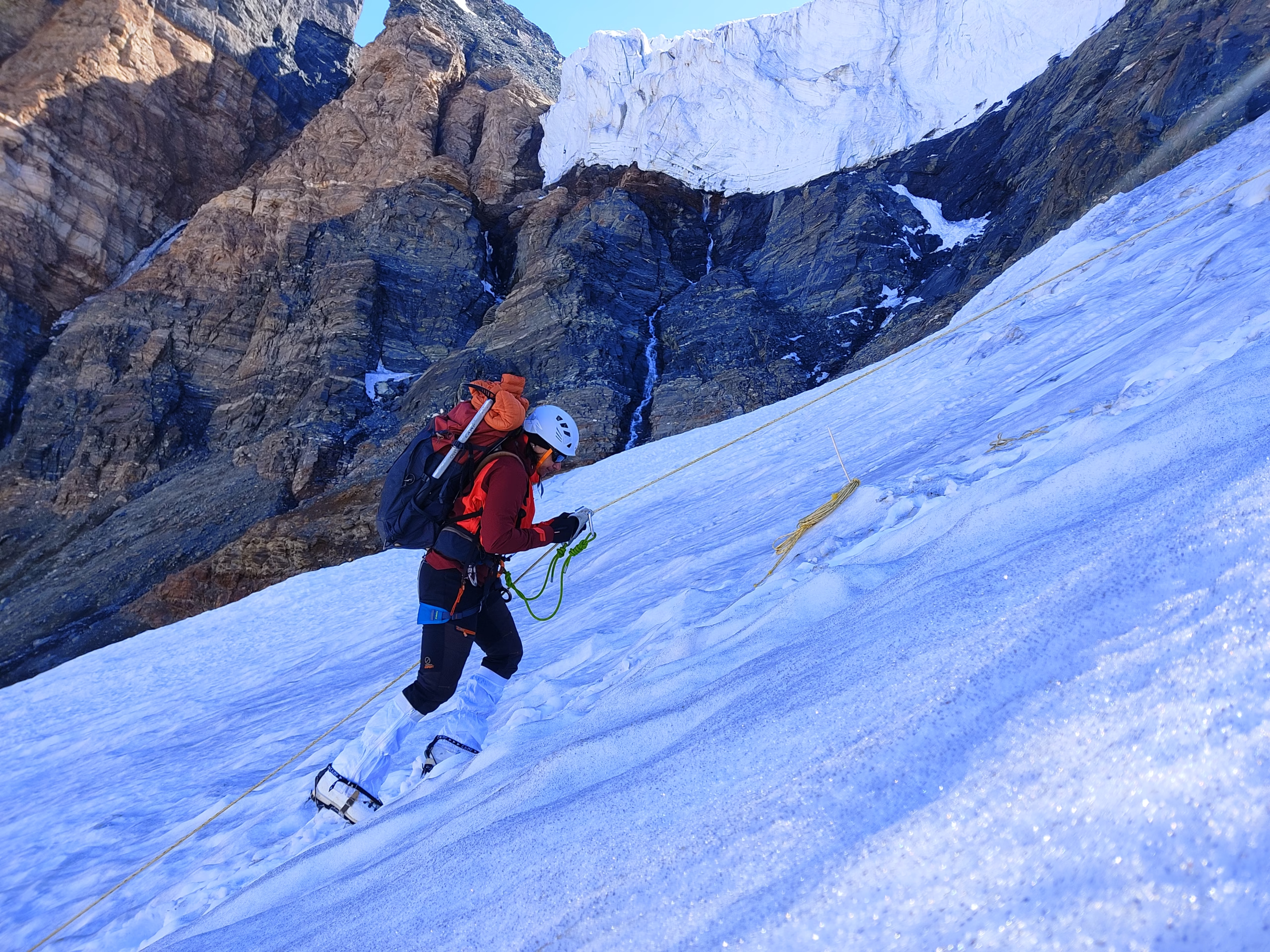
Camp 1 (5,500M): Camp 1 is at 5,500M, which is a 900M climb from Base Camp. The first part of the trail involves a two-hour hike up a steep, rocky slope after crossing the river to reach the camps. This trail has many boulders and rocks, but it is well-marked, making the climb easier. You will climb up the mountain ridge and then go down to the other side, where you must walk on large boulders—be careful until you reach a spot called 'Crampon Point.' This point is a big rock with a small opening at the bottom, which makes it a good place to store your gear and protect it from rain and strong winds. Consider it your preparation area for the trek; this is where you will put on all your gear and get ready for the climb.
The most challenging part of the climb from Base Camp to Camp 1 is a 300-meter ice wall with a 75-degree angle. After this, there’s another steep section of ice. Once you cross these, the slope becomes gentler and the snow softer. You’ll turn right, jump over some crevasses, and reach a 30-degree slope, marking the end of the fixed rope section and the start of an area with hidden crevasses. Camp 1 is in a 4-kilometer-wide snowfield, and it should take about 5 to 6 hours to reach it from Base Camp.
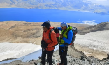
Camp 2 (6,100 meters) is a steady climb from Camp 1, gaining 600 meters in height over slopes of 60 to 70 degrees, taking around 9 hours. The toughest part involves navigating large boulders while wearing crampons.
Camp 2 offers stunning views and is perched on a narrow ridge. On one side is a steep slope, and on the other, an 800-meter drop. To use the restroom, you’ll need to anchor yourself to the rope. The views during morning and evening are breathtaking, with the sunlight creating a halo on Mt. Nun.
Camp 3 (6,400 meters), the Summit Camp, is 300 meters up from Camp 2. The path includes a steep descent followed by snow dunes at no more than 40 degrees. This leg of the journey takes about 6 hours.
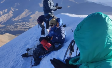
For the summit push (7,135 meters), start climbing between 11 PM and midnight when the ice is stable. The climb involves traversing 40-60 degree ice and tricky boulders. After crossing the boulders, it’s about 50 meters to the summit. The round trip from Summit Camp takes around 14 to 16 hours.
The return from Camp 3 to Base Camp will be long, with steep descents early in the morning. Stay focused, as the descent can be risky. Expect this journey to take about 8 to 10 hours.
After resting, pack up your things at Base Camp and begin the walk to Tangol. This section is easy and will take about 4 hours. Afterwards, we will get into our vehicle and drive to Kargil.
After breakfast, we will drive to Leh and arrive by evening. This day will be for celebration as we finish our expedition.
Your expedition ends here, but not without a celebration. We can’t finish this adventure without a summit party. Remember, the weather at high altitudes can be unpredictable. We suggest you keep extra days free between the end of the expedition and your travel plans to return home.
Includes/Excludes
Includes
- Camping during the trek
- Guesthouse Stay in Leh
- Trek/Expedition Meals
- Breakfast and Dinner during Hotel/Guest House Stays
- Trek Permit Fee/IMF Permission
- First aid medical kits and oxygen cylinder
- Qualified & experienced trek Leader, Guide and Support staff
- Transport from Leh to Road head and return
- Technical Equipment - Ropes, Helmet, Ice Axe, Crampons, Mountaineering Boots, Jumar, Descender, Harness.
Excludes
- Meals during road journeys
- Any kind of personal expenses
- Any kind of Insurance
- Mules or porter to carry personal luggage
- Anything not specifically mentioned under the head Inclusions
- Mandatory Liaison Officer Fee for foreign expeditions ( ~USD 500 for group of 10)
- IMF deputed liaison officer is mandatory in case of foreign nationals.
- Expense of liaison officer is distributed amongst foreign nationals equally. Approximate total expense of LO : INR 25000/-.
Packing List
This list includes essential items you need to carry for the Mt. Nun Peak Expedition. You must bring these items yourself. We have organized the list into five categories. All items are essential, except those marked as optional.
Trekking Gear
- Rucksack with rain cover (1)
- Day pack bag (recommended for treks with a summit day)
- Head torch with spare batteries (1)
- UV protection sunglasses (1)
- Water bottles (2, 1 litre each)
Footwear
- Non-skid, deep-tread, high-ankle trekking shoes (1 pair)
- Lightweight slippers or sandals (1 pair)
Clothing
- Quick-dry warm lower or track pants (2)
- Full-sleeve T-shirts or sweatshirts (1 for every 2 days)
- Thick woollen socks (1 pair for every 2 days)
- Thermal body warmer (upper and lower, 1)
- Undergarments (1 for each day)
- Warm jacket (closed at wrist and neck, 1)
- Full-sleeve sweater (1)
- Rainwear (jacket and pants, 1)
- Waterproof, warm gloves (1 pair)
- Woollen cap (1)
- Sun shielding hat (1)
Toiletries
- Personal toiletries kit (includes small towel, toilet paper, paper soap, bar soap, toothbrush, toothpaste, cold cream, etc.)
- Sunscreen lotion (small pack, 1)
- Lip balm (small pack, 1)
Miscellaneous
- Camera (optional)
- Bring plenty of your medicines for any specific health issues. Consult your doctor before you go.
- Dry fruits, nuts, and chocolate bars (optional)